
Mod Podge Nautical Map Monogram
This post may contain links to affiliate websites, such as Amazon and we receive an affiliate commission for any purchases made by you using these links.
I have always been in love with the ocean. I’m lucky and I live 9 miles from the beach. Before we moved here, we would take beach vacations during the summer. Now that I live where people vacation and can enjoy the ocean year round, I’m not quite sure what type of vacation to take. I know, I know…such a problem, right?
For those of you who have a favorite vacation spot (or for those of you whose everyday life is a vacation), here is a way for you to commemorate your favorite summer spot… a Mod Podge Nautical Map Monogram.
Did you know you can print out USGS topo maps of any area of the country for free? They are located on the USGS website, here. Search for your city, download and print!
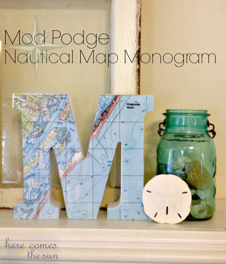
I printed out the map for Wrightsville Beach, NC. Then I just traced the outline of the monogram onto the map, cut it out and adhered it with Mod Podge. I used the same tutorial for applying the map that I used with my DIY Photo Canvas.
I used plain paper to print my image and found that after I spread the Mod Podge on the top, I could not smooth out the bubbles without scraping some ink off of the paper. I would suggest printing your map onto photo paper if possible. I used photo paper for my DIY Photo Canvas and had no problem with ink coming off.

I love my new piece of home decor. It goes perfectly with my mantel which I will be showing you soon!
For another beach related project, check out this post:
Let’s Keep in Touch!
Cute! Where do you purchase your letters?
This on was from Marshall’s.
I LOVE THIS SO MUCH!!! And thanks for the link to the map site – I have a few projects that I’ve been putting off because I couldn’t find the maps I wanted. You rock! 🙂
How pretty! I bet you have a lot of neat beachy decor in your home!
Pinned. I’m just crazy about this idea, and how it fits in with the entire vignette.
~Emily
A Tossed Salad Life
I’m so totally going to do this! What a great gift idea, too!
LOVE this, Kelly! Just saw it at Looksi…pinning!
Was looking to do this very thing and saw your tutorial-love it. I’m having a hard time getting the maps from the website to look like yours. It doesn’t show long/lat lines or have the same colors. Can you share how you managed the website. Thanks!!
Meg,
After you find the correct map, look in the upper right hand corner of the map. There will be a plus sign. Click on that and then choose the “ESRI USA Topo” option. This should give you the lat/long lines and also the colors that you see on my map.